
This weeks big hike involved a short trip south of our ranch on US Highway 285, near Bailey, Colorado. We are finally hiking the Ben Tyler trail. After living along the 285 corridor for the past 31 years and passing its trailhead hundreds of times, we finally get the opportunity to hike it!
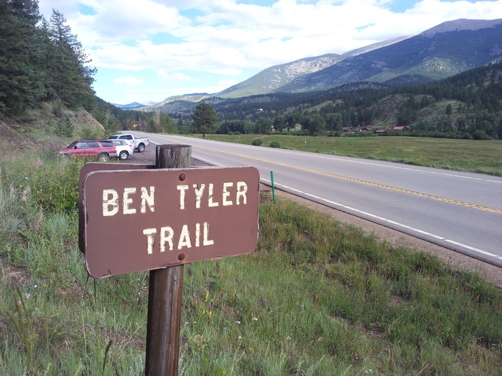
Forest Service Trail #606 was named after the original owner or the property, local lumber mill owner, Ben Tyler. Tyler harvested timber from the mountainside and operated a lumber mill during Colorado’s gold rush. He provided many a mine with shoring timbers, transported over the Kenosha Range mountains to the mining town of Fairplay, Colorado. His property is now a part of the 11,600 acre Lost Creek Wilderness Area within the Pike National Forest. The trail is rated “difficult”, its length is 11.4 miles with a elevation gain of 3,390 feet.
Directly across the highway from the trailhead is a beautiful high country meadow and three ranches. This may be the reason that lots of hikers have missed the parking lot over the years. The trailhead’s parking lot is tiny, so just a second of inattention and you can easily drive right past it. After finding a parking space we hit the trail and made a steady climb above and away from noisy US 285.
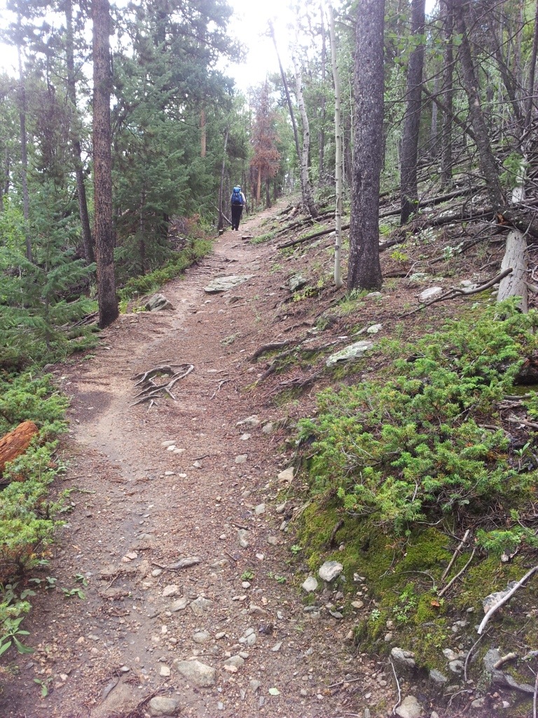
After a series of switchbacks we entered the first of several mountainside meadows, lined with sage, then heavily populated with mountain mahogany.

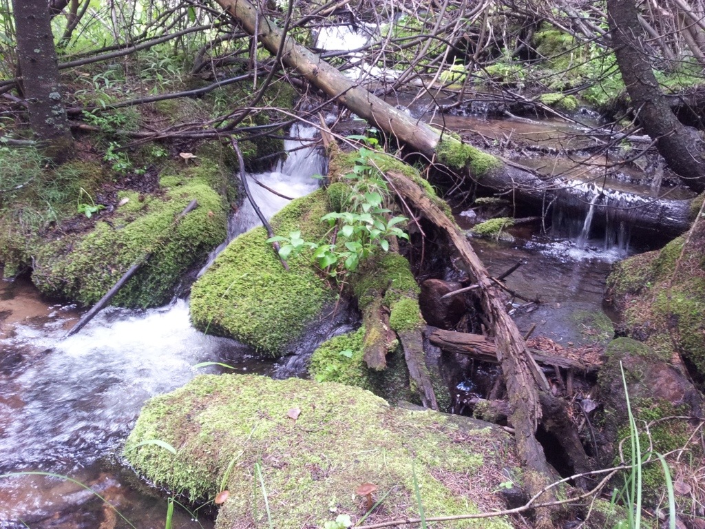
Then, the sound of a fast rushing stream could be heard, and the hillsides converged to form a narrower wet canyon. There were an amazing number of unique plants such as the blood red mushrooms, ferns, and many wildflowers and plants we have never seen in Colorado before. It was an interesting portion of the trail, for sure.

All the while we were hiking along side a beautiful little stream. The layers of green colors were just amazingly wonderful. I really enjoy hiking alongside a stream. It is totally relaxing to me.
Then the trail took us through a huge aspen grove. The grove was formed after a wildfire swept through the area in the early 1900’s. I remarked to Sandy how beautiful this area will be when the aspen trees turn golden this fall. We both agreed to hike this trail again come late September.

The weather forecast for the day predicted another day of heavy monsoon storms and sure enough they came as advertised. When a heavy thunderstorm rolled by us and literally shook the ground, we decided it was time to turn around on the trail. At this point we had covered 3.2 miles and gained over 1,500 feet in elevation, up to 9,450′.

So, we covered our backpacks with our rainflies and threw on our rain jackets and down the trail we went.
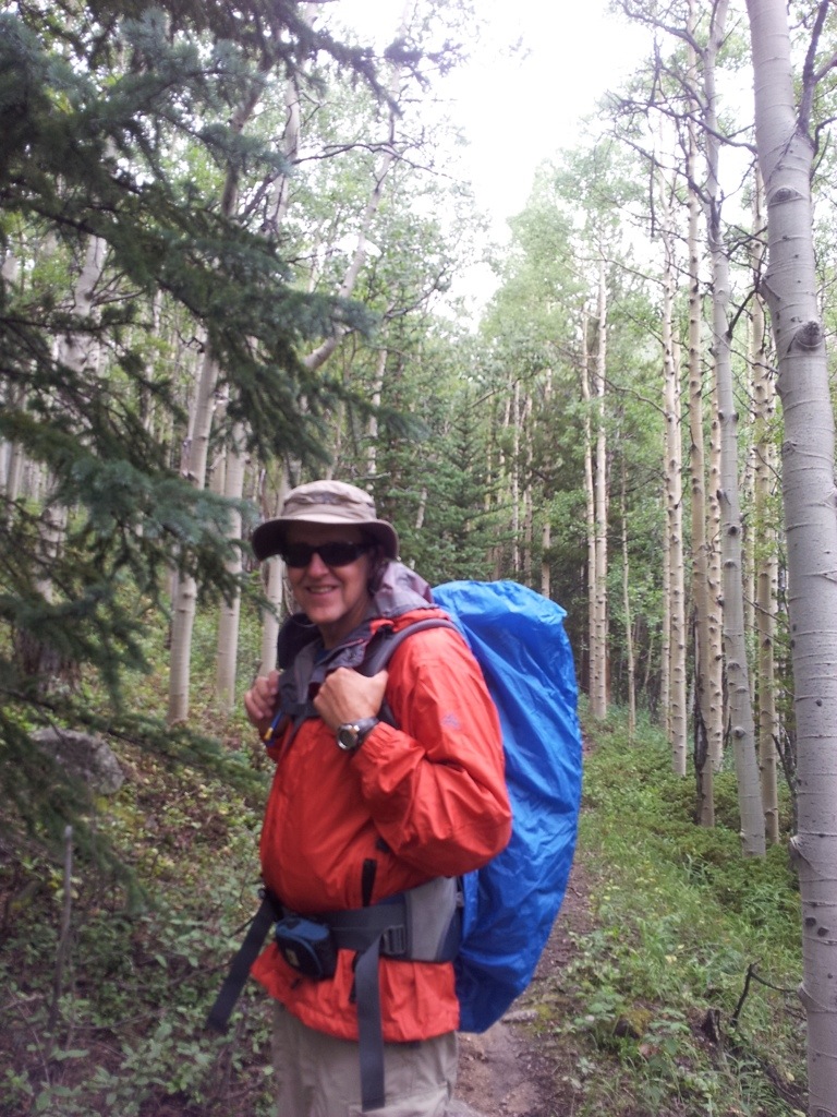
Sandy looking well prepared for the storms that rolled through. Luckily, most of the heaviest rain came down north and south of our location on the trail.

Our last stream crossing as we headed back down to the trailhead. Just as we reached the car, the heavens opened up and the rains came. Off came our heavy packs (20# for Sandy and 22# for Mark) and into the car we went. Overall, we hiked 6.4 miles with packs and lots of elevation gain. Another nice training hike for sure.

