Monthly Archives: January 2014

North Table Mountain hike in hurricane category winds

Today we decided to add some training miles while tackling another Jefferson County Open Space Park. The weather forecast was great: temperatures in the 50’s with gusty winds in some locations. We decided to head down to the Golden, CO area where we would give North Table Mountain Open Space Park a try.
North Table Mountain Park has just under 2000 acres of land and lots of wildlife – all situated high between Golden and metro Denver. Lava flows formed North Table Mountain and it sister mesa, South Table Mountain, some 60 million years ago. Jefferson County’s aggressive open space program acquired both the north and south mesas which would ensure the natural beauty for future generations. The park’s 15 miles of trails fit well with our desire for a double digit distance hike today.
We left our ranch at about 0920 and the weather was perfect. As we were driving north along the hogback, we noticed that the winds were picking up a bit. This was a sure sign that the upslope winter storm which was to hit on Monday was working it’s way into Colorado.
We arrived at the trailhead parking lot around 1000 and grabbed the last remaining parking space. It seemed like everyone else in the area had the same idea we did! Once on the trail, it became apparent that the winds were going to be an issue. At the start, I estimate the average winds to be between 35-45 MPH with some gusts up to 60 MPH. Well, we heard that there are portions of the Camino that are windy, so this would make for a good training situation. About halfway up the steep incline, we had some interaction with hikers and joggers on their way down. One reported, “The winds get worse up at the top.” Great!
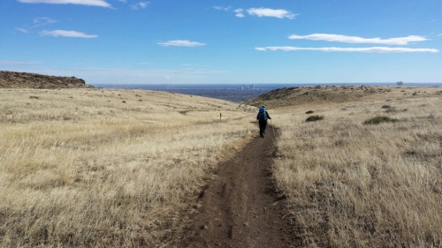
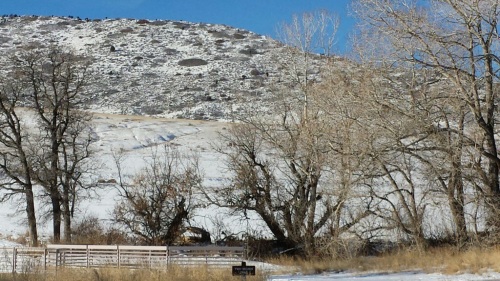
20140126-164235.jpgWe finished climbing the 15-20% grade while working our way up the northern slope of the mesa. We were both carrying packs with 20-25 pounds of our gear. We were aided by the strong tail wind, which nearly knocked us over on several occasions. The packs often acted like mini-sails.
You will notice fewer photos than normal on this blog entry. This, as a result of the wind nearly blowing the camera out of my hands on a couple of occasions. Take my word for it, it was windy!
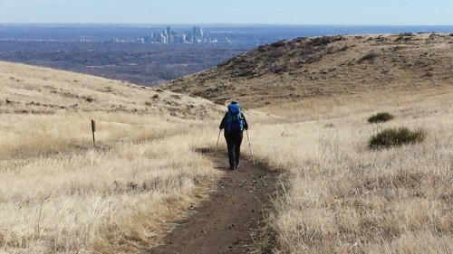
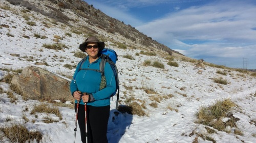
20140126-164310.jpgThere were some really interesting volcanic rock formations, ponds, streams and peaks on the mesa, but quite frankly we were literally getting blown all over the trail, so taking the time to enjoy these features was not high on the “to do list.” Just trying to keep your gait correct and staying on the trail was job number one. In this photo, Sandy is working her way down the east side of the Mesa trail.
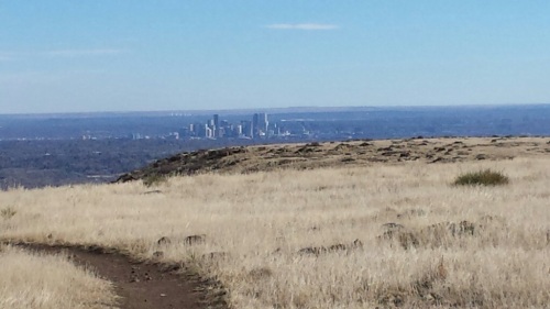
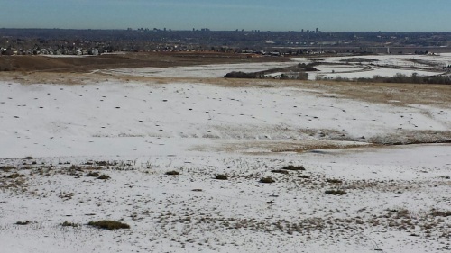
20140126-164325.jpgThe City and. County of Denver from above. This was the photo that resulted in me catching the camera as the wind blew it out of my hand. I decided not to risk damaging the camera so no more hiking photos on this trek. Once the trail winded back up to the top, the winds increased to a steady 55-60 MPH. When there was a second or two of no wind, you would nearly fall over from your overcompensation. During the entire hike, Sandy led the way. I have to give her major kudos as she never complained and maintained a great pace. Once we arrived at a decision point on the trail, we decided discretion was the better part of valor and took the quickest trail back to the lot. The trail back was a constant 21% decline (according to my hiking app) which was a bit hard on the knees. All tolled, we hiked 6.0 miles under pretty miserable conditions. We had a 773′ elevation gain. Our hike started out at 5,990′ and topped out at 6,550′. We both agreed that we would like to return on a better weather day to more thoroughly enjoy the park.
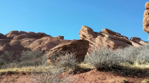
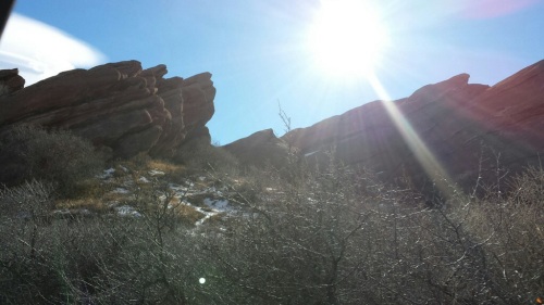
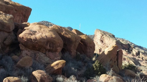
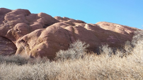
20140126-164337.jpgOn the return trip home, we decided to swing through Red Rocks Park. It is simply spectacular. We took a few photographs from the car as the park road winds it’s way through the amazing red rock formations. Yes, I felt guilty about so few photographs on the hike I had to offer this bonus. Enjoy and Buen Camino!

20140126-164348.jpg

20140126-164356.jpg

20140126-164404.jpg

Leave a comment

Filed under Mark & Sandy's Camino 2014

Hildebrand Ranch Open Space Park

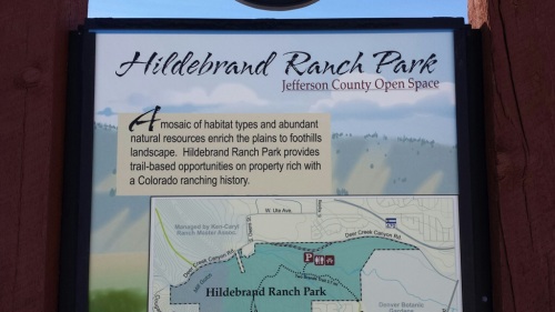
20140112-130032.jpgWe started out with plans for our long training hike this week with two goals in mind. Complete another Jefferson County Open Space Park and hike in a location which would have less snow than our local foothill parks. So, with only three Jeffco Open Space parks left before we can claim to hiked them all, and an low elevation of 5,532′ – Hildebrand fit the bill. This park is located at the foot of the Lyons, Dakota and Niobrara hogback rock formations. In 1866, Frank and Elizabeth Hildebrand homesteaded the property and raised grain crops, vegetables and cattle. In its time, it was one of the more successful ranches in the area.

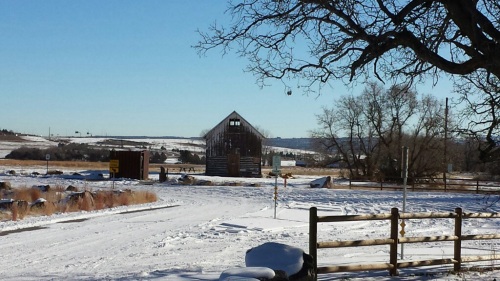
20140112-130050.jpg The parking lot is located along Deer Creek Canyon Road and has some neat old ranching structures nearby. One of the most interesting “green” aspects is the use of brick pavers for the entire parking lot and sidewalks. Below the pavers is a layer of pea gravel. This allows rain and snow to percolate through the spaces around the bricks and back into the soil. I am sure this added quite a bit to the development of the park, but was a pretty impressive and environmentally sound effort at restoring groundwater to this ecosystem.

20140112-130100.jpgThe hike begins with a crossing of Deer Creek and begins a steady grade up through the old hay meadows on “Two Brand Trail.” I found it interesting how the old ranchers cut in their irrigation ditches as they tried to make the most out of irrigating their meadows. I bet it was often quite the battle given Colorado’s semi-arid climate.

20140112-130124.jpgThe trail hugs the base of the hogback and is a single track. There were some parts of the trail that offered some interesting views of the northern Douglas County foothills. However, I found it difficult to overlook the HUGE power lines which bisected the park. This photo was taken from the trail’s high point, looking east toward the Cherry Creek area.

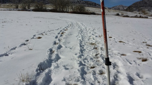
20140112-130223.jpgSandy on the trail. There were some ancient and quite interesting rocks along the trail. I was paying special attention to them to see if I could find some fossils imbedded in them. The hogback is famous for its fossils, in fact just a few miles away there is a really neat dinosaur museum. The park is currently under development and I’d call it a work in progress. it is bordered by a residential neighborhood, and has huge unsightly power lines cutting through it. So, on a beauty factor I would rate it as a 5 on a scale of 10, but nevertheless it was our trail for the day. The loop takes you to the base of the rocky hogback south and then east toward Chatfield State Park. Then, it cuts right through a residential community. So, the poles went back on the backpacks and we hiked amid barking dogs and traffic. After about 15-20 minutes of urban hiking the trail took us back into open space and chirping prairie dog colonies.

20140112-130231.jpgThe trail loop was a total of 5.1 miles of fairly level hiking (only 362′ altitude gain) but the hiking was a bit difficult due to the snow and icy trail conditions. Thank God for hiking boots, because without them we both would have twisted our ankles at least a dozen times each. It was like hiking through miles of lumpy mashed potatoes. On a positive note, the trail provided an opportunity to test run our solar charger while our hiking app was draining our Galaxy S4’s battery. It actually really did well, keeping the battery charged to 88% during the entire trek. Without the solar charger, it would have been in the 60% range.
Buen Camino!

Leave a comment

Filed under Mark & Sandy's Camino 2014

Camino de Santiago update, hiking and more!

Happy New Year everybody! Well, I have to admit I have been a bit of a slacker recently with regard to my weekly posts, but the holidays have a tendency to get quite busy around these parts. It was great to spend additional time with our family and we had loads of fun in Colorado’s great outdoors.

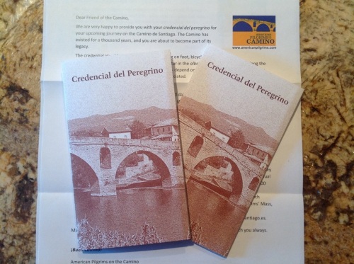
On the Camino de Santiago news front, we were surprised on New Year’s Eve day to receive our official “Credencial del Peregrino” from the American Pilgrim on the Camino organization. This is the official pilgrim’s passport, stamped every day as you progress from village to village along your route. The passport opens up “accordion style” to create 14 pages. As a peregrino, you are required to obtain one stamp per day, usually at your refugio or albergues. On the last 100 Km, pilgrims are required to have two stamps added per day. Here is what our newly arrived passports looks like:

20140102-091804.jpg
Here is what a completed page of passport stamps looks like:

20140102-095046.jpg Once you arrive in Santiago de Compostela, Spain, you check in at the office and present your passport to the staff. They are closely scrutinized and questions are asked about your journey. If approved, you are issued your “Compostela.” The Compostela is completed in Latin and is your “certificate of accomplishment” given only to pilgrims who have completing the Way of Saint James.

In any event, the receipt of our Camino passports signal the time is nearing for our big journey. To that end, we have been working on completing our trip planning for Europe. First things first…Before leaving, we will mail off our Camino packs with all of our hiking gear to our great Italian relatives in Genoa. We will leave the states with our travel bags and fly into Rome toward the end of Feburary. After a few days in Rome we are off to Sicily for a week. We then travel across the Straits of Messina to southern Italy. We have allotted just over a week to explore Italy’s southern regions and Adriatic coastal towns. Then, we spend a week with relatives in Liguria. At this point, we will transition to our Camino hiking packs and ship our travel bags back home. After Genoa, we head up to France. We will spend a week exploring Paris, Amiens, and the Normandy coast. A few train rides later, we will be in Saint Jean Pied de Port, FR – where we will begin the Camino de Santiago. Since we are starting the Camino early in spring, we have scheduled 45 days to complete it. It usually takes around 32-34 days, but we wanted to be safe. After completing the pilgrimage we will be off to Madrid where we have friends who promise to provide a grand tour of the city. We head back home to the USA in mid May.

20140102-095055.jpg
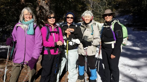
In the meantime, Sandy and I continue to hike. We know that we can now hike 12+ miles per day at our altitude, so our goal is to stay in hiking shape without pushing ourselves too hard. We know the Camino will be a major challenge, but are looking forward to all of the lifelong experience it will bring to us. Yesterday we, acting in our role as State Park Volunteers, lead a 7+ mile “First Day Colorado” hike up the Mason Creek Trail in Staunton State Park. We hosted four hearty hikers who braved the 20 degree temperatures to hike a trail with 1,300+ foot elevation gain to 9,344′ elevation. The trail was 85% snow packed with a powdery snow which made the 7.5 miles seem like a lot more. It felt like walking on a beach (at nearly 10,000′ elevation). Just wondering here out loud if there is such a beach??? All in all, we met new friends, had a great time and REALLY REALLY looked forward to our Starbucks caffe lattes afterwards.

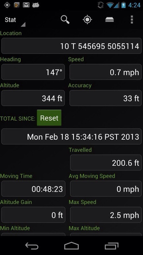
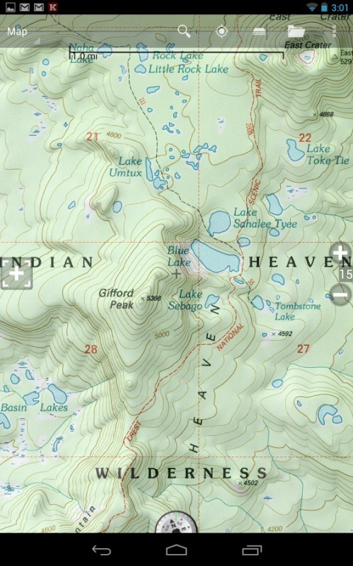
20140102-092505.jpgWhile on the hike I had the opportunity to try out a new app I loaded into my Samsung Galaxy G4. It is called “Back Country Navigator and it is amazing. Here is a link to their website: http://backcountrynavigator.com
I copied a couple of their screenshot photos to show the amount of data the app provides and the great quality of topo maps available.

20140102-092955.jpg

20140102-093006.jpg

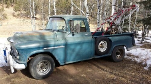
Finally, I thought I would show off another retirement project we have been working on. This is our ’55 Chevy 3600 pickup truck which we call “Towmater.” We found it several months ago in a state of disrepair in the small town of Salida, CO. It was used as a tow truck for the local garage for years. The tow apparatus is a hand crank system from the 1920’s. We fell in love with it as did our grandchildren. It is now running and our son-in-law Alex (who lucky for us is a master mechanic) is helping out with the little things that go wrong on a nearly 60 year old motor vehicle. Always busy here on the ranch!

20140102-092515.jpg
That’s all for now and Buen Camino everyone!

Leave a comment

Filed under Mark & Sandy's Camino 2014